Volcanoes have always fascinated me. In case you didn’t know, Iceland’s unique geology contains over 30 active volcanic systems, requiring constant vigilance. I’m glad to report that drones are now a key player in Iceland volcano monitoring.
Volcanoes can dramatically impact both the environment and local communities. Drones provide a safer, more efficient way to gather crucial data, offering real-time insights that help predict eruptions and mitigate risks.
In this post, we’ll examine how drone technology works in this field and why it’s so crucial. We’ll explore the types of data drones collect, their benefits, and what’s next in drone-based volcano monitoring. By the end, you’ll understand the game-changing role of drones in keeping an eye on Iceland’s fiery giants.
The Geology of Iceland and Its Volcanic Activity
Iceland is a beautiful, rugged land of fire and ice, with its breathtaking landscapes shaped by dramatic geological forces. The island sits at the junction of the North American and Eurasian tectonic plates, making it one of the most volcanically active regions on earth.
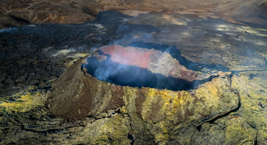
Photo by Björn Austmar Þórsson
Understanding Iceland’s Volcanic Systems
Types of Volcanoes in Iceland
If you didn’t know, there are different types of volcanoes. Iceland showcases a variety of volcanic systems, including stratovolcanoes and fissure eruptions.
- Stratovolcanoes
- These are large, cone-shaped volcanoes made of layers of lava, ash, and other volcanic debris. Stratovolcanoes tend to have explosive eruptions.
- Examples include Mount Hekla and Eyjafjallajökull (click to hear pronunciation).
- Fissure Eruptions
- Unlike stratovolcanoes, fissure eruptions occur when magma rises through cracks in the earth’s crust. These eruptions can spread lava over large areas.
- The Laki fissure eruption in 1783 is a famous example.
Iceland’s position on the Mid-Atlantic Ridge means the island is constantly being pulled apart, allowing magma to reach the surface and form these unique volcanic features.
Recent Eruptions and Their Impact
Significant Eruptions in the Last Decade
In the past ten years, several notable eruptions have captured global attention:
- Eyjafjallajökull (2010)
- This eruption caused widespread ash cloud, disrupting air travel across Europe for weeks and impacting air quality.
- Bárðarbunga (2014-2015) (click to hear pronunciation)
- Bárðarbunga’s eruption led to the largest lava flow Iceland had seen in over 200 years. It significantly impacted local air quality and contributed to greenhouse gas emissions.
Effects on the Environment and Local Communities
The impact of these volcanic activities is profound:
- Environmental Impact
- Volcanic ash can fertilize the soil but also disrupts ecosystems.
- Lava flows alter landscapes and create new landforms.
- Community Impact
- Local communities are directly affected by ash fall, which can damage crops, water supplies, and infrastructure.
- The 2010 eruption of Eyjafjallajökull led to the evacuation of nearby towns and heavily influenced the local economy, especially tourism.
Understanding Iceland’s geology and volcanic activity helps volcanologists prepare and mitigate the impacts on both the environment and local populations. The island’s fiery nature is a reminder of the power of our planet’s geological processes.
The Role of Drones in Volcano Monitoring
Drones have transformed the way scientists and researchers monitor volcanic activity. By providing real-time data and safe access to hazardous areas, drones have become an invaluable tool in the study and observation of volcanoes. Let’s explore the key advantages and the types of data drones collect.
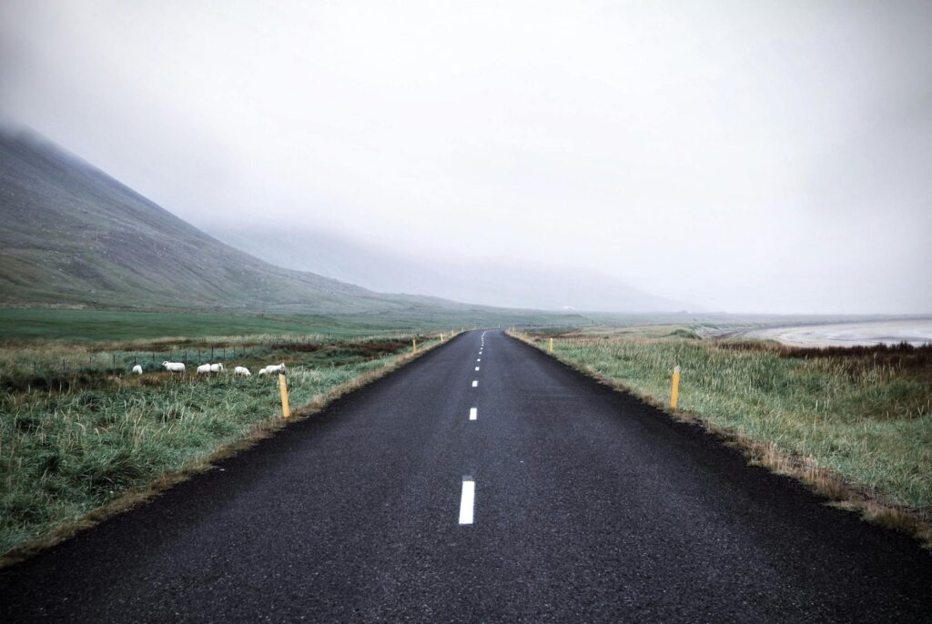
Photo by Tiana
Advantages of Drone Technology
Using drones for volcano monitoring offers several significant benefits that traditional methods can’t match. Here’s a look at some of the most compelling advantages:
- Accessibility to Dangerous Areas: Drones can easily access locations that are too dangerous for humans. They can fly into active volcanic craters and over unstable terrain, keeping researchers safe while still gathering essential data.
- High-Resolution Imaging: Drones are equipped with high-resolution cameras that capture detailed images and videos. This imaging capability helps scientists analyze volcanic features and monitor changes over time.
- Cost-Effectiveness: Compared to helicopter surveys and ground expeditions, drones are not only safer but much more cost-efficient. They require fewer resources and can be deployed quickly, making them an economical choice for ongoing monitoring efforts.
Types of Data Collected by Drones
Drones collect a variety of data quickly that helps scientists understand volcanic activity. Different sensors and cameras on drones capture specialized information:
- Thermal Imaging: Drones with thermal cameras can detect heat signatures from volcanic activity. This data helps researchers identify hot spots and assess the flow and eruption patterns of lava.
- Gas Emissions: Specialized sensors on drones can measure gases like sulfur dioxide and carbon dioxide. Monitoring these emissions provides clues about magma movement and the likelihood of future eruptions.
- Topographical Mapping: Drones equipped with LiDAR (Light Detection and Ranging) technology create detailed 3D maps of volcanic landscapes. These maps are crucial for understanding the topography and changes due to eruptions, landslides, and other seismic activities.
By utilizing drones, scientists rapidly gather comprehensive data without risking their lives. This technology not only enhances our understanding of volcanoes but also helps in forecasting eruptions and protecting communities living nearby.
Case Studies of Drone Monitoring in Iceland
Drone technology has become a vital tool in monitoring volcanic activity in Iceland. From tracking ash clouds to ensuring public safety, drones provide real-time data and stunning visuals that are essential for understanding volcanic behavior. Here, we will explore two significant case studies: the 2010 Eyjafjallajökull eruption and the recent Fagradalsfjall eruptions.
Eyjafjallajökull Eruption Monitoring
The 2010 eruption of Eyjafjallajökull caused massive disruptions in air travel due to its extensive ash plumes. During this event, drones played a crucial role in monitoring and assessing the situation.
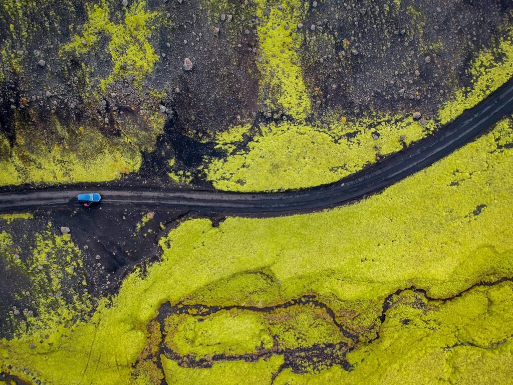
Photo by Tomáš Malík
Scientists used drones to:
- Measure the height and density of ash plumes, which was critical for determining flight safety.
- Capture high-resolution images and videos, aiding in the creation of accurate predictive models.
- Provide real-time updates that helped in coordinating emergency responses and airport closures.
For more insight on the Eyjafjallajökull eruption and its impact on air travel, visit Smithsonian Magazine.
Fagradalsfjall Volcano Eruptions
In recent years, the Fagradalsfjall eruptions have underscored the importance of drones in real-time monitoring and public safety. Drones were deployed extensively, offering new perspectives and unprecedented data.
Key applications of drones during these eruptions included:
- Real-time monitoring: Drones provided live feeds, allowing scientists to track lava flows and gas emissions as they occurred. This immediate data was crucial for predicting the volcano’s behavior.
- Public safety: The real-time data helped authorities issue timely warnings and evacuation orders, ensuring the safety of nearby residents and tourists.
- Visual documentation: High-definition footage captured by drones offered stunning views and served as valuable documentation for future research and public education.
For a detailed overview of the role of drones in the Fagradalsfjall eruptions and aerial footage, check out this BBC News article.
The drone technological revolution has improved how we monitor and respond to volcanic activity, making it an indispensable tool for scientists and emergency responders alike.
Challenges and Limitations of Drone Monitoring
Monitoring active volcanoes with drones offers groundbreaking insights, but it comes with its own set of hurdles. Understanding these challenges is crucial for effective and safe operations.
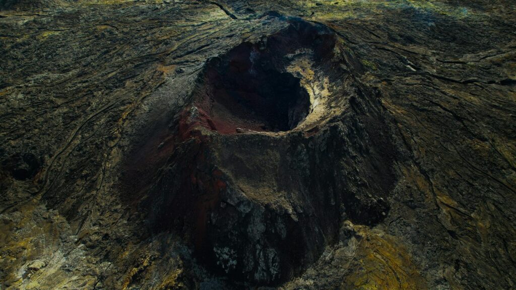
Photo by Björn Austmar Þórsson
Regulatory and Safety Considerations
Operating drones in volcanic areas is not as simple as just flying them over. Regulationsset by local and international bodies play a big role. In Iceland, for example, Icelandic Transport Authority sets specific rules for drone flights. These rules are designed to protect both the drone operators and the public.
Key regulatory considerations include:
- Airspace Restrictions: Certain zones around volcanoes might be restricted to prevent accidents. You need permission to fly in these zones.
- Safety Protocols: Operators must follow strict safety procedures. This includes maintaining a line of sight with the drone and ensuring it does not interfere with emergency rescue operations.
Following these rules is crucial to avoid legal issues and ensure the safe collection of data.
Technological Limitations
While drones offer a lot of advantages, they also come with technological constraints that can affect their performance. Here are some of the main limitations:
- Battery Life: Drones usually have a limited battery life, which restricts their operational range. This can be a big problem when you need to cover large volcanic areas.
- Data Accuracy: Extreme weather conditions, such as high winds and ash clouds, can interfere with data collection. This affects the accuracy and reliability of the information gathered.
- Signal Interference: Volcanic terrains can cause signal disruptions, making it difficult to control the drone and receive real-time data.
- Payload Limitations: The amount of equipment a drone can carry is limited. This means you might need multiple drones to carry different sensors, which increases the complexity and cost of the operation.
Technological advances are ongoing, and many of these limitations are expected to diminish over time. For now, acknowledging these limitations allows drone operators to better plan their missions and utilize drones more effectively.
Future of Drone Monitoring in Iceland
As technology advances, so does our ability to monitor and predict volcanic activity. Drones are becoming an essential tool, especially for a country like Iceland, which sits on a volcano belt. Let’s explore the innovations in drone technology.
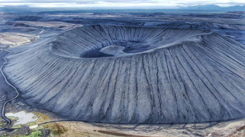
Photo by Miles Iwes
Innovations in Drone Technology
One of the most exciting aspects of drone technology is its rapid evolution. With each passing year, drones are becoming more advanced and capable of performing a wide range of tasks. Here are some key innovations that could shape the future of drone monitoring in Iceland:
- Artificial Intelligence (AI): AI can help drones make real-time decisions based on the data they collect. For instance, AI algorithms can identify patterns in volcanic activity that might indicate an impending eruption. This makes the data more actionable and timely, allowing for quicker responses.
- Improved Sensors: Modern drones are equipped with a plethora of sensors, such as thermal cameras, gas detectors, and high-resolution cameras. These sensors can provide comprehensive data about the volcano’s condition, including temperature changes, gas emissions, and structural integrity.
- Autonomous Flight: Advances in autonomous flight technology allow drones to survey large areas without human intervention. This is crucial in hazardous environments, where it may be too dangerous for humans to venture.
These innovations not only make drones more effective but also safer and more reliable tools for monitoring volcanic activity in Iceland.
Conclusion
Drone monitoring is a game-changer in managing volcanic risks in Iceland. It provides real-time data and insights that are crucial for safety and planning.
With drones, scientists can predict eruptions and mitigate their impact, protecting both lives and property.
As technology advances, the possibilities for using drones in geological studies will only grow.
Thank you for reading. Feel free to share your thoughts or experiences with drone technology in the comments.
