Drone photography in construction is reshaping the way projects are managed. Once dismissed as mere tech gadgets, drones have swiftly evolved into essential tools, providing new perspectives that enhance construction work. With their ability to capture high-resolution aerial imagery and offer unparalleled site details, drones are cutting down costs and boosting efficiency. They’re now a regular fixture on construction sites, replacing traditional methods with real-time progress tracking and top-notch safety inspections. By effortlessly providing comprehensive construction progress photos, drones allow project managers to stay ahead, adjusting strategies rapidly based on the clear and detailed aerial insights. As technology advances, the role of drone photography continues to expand, making it an indispensable asset in the modern construction landscape. Top general contracts know this and utilize drones on all their projects.
Understanding Drone Photography in Construction
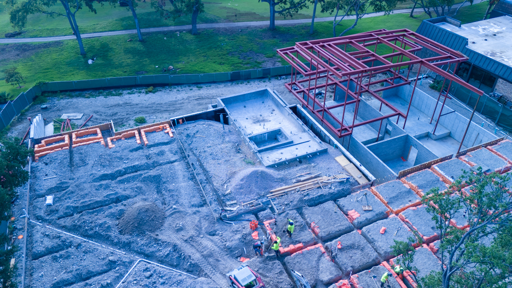
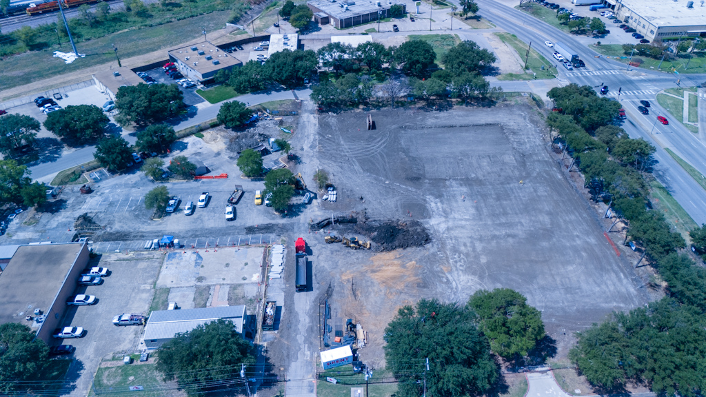
Drone photography is revolutionizing the construction industry. By offering unique aerial views and unprecedented angles, drones enable project managers to capture detailed construction progress photos. They provide a real-time overview of construction sites, enhancing decision-making processes and project management.
The Benefits of Drone Photography
Drones have rapidly become an essential tool for documenting and monitoring construction projects. Here’s why:
- Comprehensive Views: Aerial imagery from drones offers a bird’s-eye view of construction sites. This helps in assessing the overall layout and planning adjustments if needed.
- Time Efficiency: Frequent and rapid data collection allows for constant monitoring, helping to accelerate project timelines. Construction managers can easily observe various stages of development without setting foot on the site.
- Cost Reduction: Using drones reduces the need for costly manned aircraft or physical inspections. This technology streamlines processes, saving resources for companies.

Capturing Construction Progress
How do drones achieve such detailed and useful imagery? Here’s the process:
- Choosing the Right Equipment: Quality cameras and stabilizers are pivotal. The right drone can capture high-resolution images that are crucial for detailed analysis.
- Planning the Flight: Careful planning of flight paths ensures comprehensive coverage of the site. This involves choosing strategic angles to document each stage of construction effectively.
- Data Analysis: After capturing images, drones can feed visual data into software that assists in creating 3D models or maps of the project. This data can be used for improving project accuracy and reducing errors.
Enhancing Safety and Accuracy
Drone photography significantly enhances safety on construction sites. Here’s how:
- Remote Monitoring: Drones can access hard-to-reach areas, reducing the need for personnel to enter potentially dangerous zones. This makes worksites safer for everyone involved.
- Error Reduction: Real-time monitoring and detailed imagery help in identifying errors or potential issues early, allowing for proactive problem-solving and correction.
Drone photography in construction is not just about capturing stunning images; it’s about enhancing productivity and ensuring that projects run smoothly and safely.
Benefits of Aerial Perspectives in Construction
Drones are revolutionizing how construction projects are managed. By offering an aerial view, they provide crucial data that can reshape decision-making, enhance safety, and cut costs. Let’s dive into some of the key benefits.
Enhanced Site Monitoring
Imagine being able to see your construction site from the sky, like a bird gliding high above the ground. Drones make this possible, allowing for real-time monitoring of construction progress and site conditions. This bird’s-eye view is not only visually stunning but also efficient. Project managers can now capture construction progress photos that offer a clear snapshot of what’s happening on-site without ever setting foot on the ground.
Consider the typical hassles of walking through a large site to assess progress. With drone photography in construction, surveying the entire happens quickly, helping to ensure timelines stay on track and productivity remains high. Regular updates from the air can help to quickly identify lagging areas and make swift corrections, ensuring a seamless workflow.
Improved Safety Measures
Safety should never be an afterthought in construction. Drones help in spotting potential hazards that may be missed from the ground. By providing detailed aerial imagery, drones enhance situational awareness, making it easier to identify and address safety risks promptly.
Think of drones as vigilant guardians of your site. They scan the area and generate comprehensive visual data which ensures all safety regulations are met. This proactive approach to site safety not only prevents accidents but also boosts morale, knowing that everyone on-site is working in a safer environment.

Cost-Effective Solutions
Traditionally, surveying and inspecting construction sites demanded substantial resources—and money. Now, drones offer a cost-effective solution. By using drones, companies can reduce costs associated with these activities significantly. No need for expensive scaffolding or hiring professionals for manual inspections.
When considering the financial impact, aerial drone services are both affordable and potent. They cut down on labor costs and can complete jobs faster. You no longer need to hire external manpower for various tasks when a single drone flight can cover all aspects of monitoring and inspection. According to studies, the use of drones has significantly improved productivity and cost-effectiveness on construction sites, providing a competitive edge in the industry.
In conclusion, embracing drone technology not only enhances your perspective but it also elevates the standard for monitoring, safety, and cost management.
Transformative Examples of Construction Documentation
In the construction industry, capturing project progress is crucial for keeping everyone informed and on track. Drone photography has rapidly emerged as a versatile tool, significantly transforming how construction projects are documented. Let’s explore how drones are used across large-scale projects and deepen stakeholder engagement through detailed imagery.
Case Study: Large-Scale Projects
Large construction projects spanning over months or even years, necessitate effective documentation to track progress, monitor budgets, and ensure timelines are met. Drone photography offers a bird’s-eye view of the construction site, providing comprehensive progress photos that are difficult to achieve through traditional means. For example, many projects, such as international airports, vast commercial spaces, or large residential complexes, have embraced drone photography to capture their continuous evolution.
The drones fly over and capture images at various stages, showcasing the project’s transformation from groundbreaking to completion. Regular drone surveys can deliver valuable insights into different project phases, enabling teams to pinpoint potential delays or inefficiencies before they escalate.
- Five Case Studies for Drones in Construction highlights how drones have helped in surveying new job sites and aiding ongoing maintenance.
- Drone Services Case Studies offer detailed analyses of how these aerial tools have transformed documentation processes for various large projects.
Drones don’t just take pictures; they provide data that can integrate with construction management software, further enhancing the way teams handle their projects.
Documenting Progress for Stakeholders
Keeping stakeholders informed is vital for any construction project. Drone imagery makes it simple to update investors, clients, and subcontractors without the need to physically visit the site. Through virtual tours and high-resolution images, stakeholders can visualize progress from anywhere in the world, fostering a transparent and reliable communication channel.
This capability is particularly beneficial because:
- Regular Updates: Sharing high-quality aerial imagery at regular intervals, ensures everyone is on the same page regarding project milestones.
- Improved Insights: Stakeholders can provide input based on actual, up-to-date visuals, which aids in decision-making processes.
- Engagement: By offering a real-time, visual narrative of the project, stakeholders remain more engaged and committed to the project’s success.
By utilizing drone photography, construction managers can ensure that every phase of the project is meticulously documented and effectively communicated, making the construction process smoother and more transparent than ever before.
Detailed Insights Over Time
Drone photography in construction offers a revolutionary way to keep track of how projects develop. It provides precise, consistent, and detailed images that are indispensable for gauging progress over time. By using drones, construction professionals can gather aerial imagery efficiently. This technology isn’t just a nifty tool; it has fundamentally transformed how we see, plan, and execute construction tasks.
Comparative Analysis of Progress
One key advantage of drone photography is its ability to capture images from consistent angles and elevations over time. These consistent images enable a clear comparative analysis of the construction progress at different stages. Think of it like flipping through the pages of a picture book, where each page shows the growth of a project from foundation to finishing touches.
- Regular Monitoring: Drones can fly over construction sites daily, weekly, or monthly, capturing the development with precise pictures. This consistency allows for a detailed comparison of structural growth.
- Visual Documentation: By comparing sequential aerial images, stakeholders can instantly see where their projects stand. This comparative process reveals what parts of the project are ahead, on time, or falling behind.
- Error Detection: Having a timeline of images can highlight discrepancies or errors that might otherwise go unnoticed until they become costly fixes.
Data Integration with Project Management Tools
Drone data isn’t just for reflecting on what’s been done; it can actively enhance project management and planning. By integrating this data with software tools, construction teams gain a robust mechanism to enhance project management.
- Software Compatibility: Drone photos can be uploaded into construction project management software, where they assist in planning and scheduling. Applications like Procore are designed to integrate these visuals seamlessly.
- Data-Driven Decisions: With high-resolution images available, project managers can make informed decisions backed by visual evidence rather than just relying on reports.
- Resource Allocation: When images clearly show a project’s status, it becomes easier to allocate materials, workforce, and time, ensuring more efficient use of resources.
The blend of drone photography with advanced data tools represents a significant shift in construction industry practices. This combination not only enhances visibility but also bridges the gap between the physical site and the digital project environment.

Future Trends in Drone Photography for Construction
The world of construction is always changing, and how we use technology plays a big role in this. Drone photography in construction is one area that’s super exciting, with a lot of new trends on the horizon. From smarter drones to better data analysis, these tools promise to make building projects faster, safer, and more efficient. Let’s take a peek at some of these future trends.
Enhanced Camera Technology
The future holds even higher resolutions and dynamic range, making construction progress photos clearer and more detailed. This allows builders to capture every inch of a site, spotting issues long before they become problems. Improved camera specs provide a clearer aerial view, turning complex data into actionable insights.
Integration with AI and Machine Learning
AI isn’t just for smart speakers or cars; it’s changing how we use drones too. Future drones will not only capture stunning photography but will also process and analyze data in real-time using AI and machine learning. This means faster decision-making and more accurate predictions about potential issues on the site. Autonomous drones can analyze structures, track equipment, and even predict potential delays, ensuring your project runs smoothly.
Expanding Market and Opportunities
By 2030, it’ll be hard to picture construction sites without drones buzzing overhead. The demand for drones in this field is expected to skyrocket, with a projected market value of over $6 billion. What’s driving this growth? Builders are recognizing the value of aerial imagery in not just capturing photos but in improving safety and efficiency. More companies will invest in drone technology as it saves both time and money on projects.
For more market insights, check out this analysis.
Greater Autonomy and Task-Based Functionality
Gone are the days when drones needed constant human guidance. Future models are expected to bring more autonomy, operating on pre-set paths and conducting specific tasks without human intervention. This means fewer hands are needed on the ground, allowing project managers to focus on other critical tasks while drones carry out repetitive or dangerous work with precision.
Find out how these technologies will reshape construction in the next decade here.
Each of these trends points toward a future where drones aren’t just flying cameras but are crucial parts of the construction team. They’re like new players on the field, ready to change the game in ways we can barely imagine today. Are you ready for the future of construction?
T.A.P. SUMMARY
Drone photography in construction is reshaping the industry in profound ways. By providing real-time aerial insights, it enhances the precision of construction progress photos and boosts efficiency across projects. From improved safety protocols to cost-effective project management, the integration of drones offers unmistakable advantages.
As we embrace this technology, the future of construction looks promising with the seamless incorporation of aerial imagery. Explore how you can harness these benefits and stay ahead in the construction landscape.
If you are wondering whether your company should invest in a drone fleet or contract it with Texas Aerial Photographers, click here for an analysis.
Thank you for exploring this transformative tool with us. We look forward to seeing how drone photography will continue to innovate and inspire. Share your thoughts or questions in the comments below.
